
The 11-Day Dolomites Alta Via Itinerary: The Health-Smart Version (Alta Via 1)

The Alta Via 1 runs 115 km north to south through the Italian Dolomites, from Lago di Braies at 1,496 m to La Pissa near Belluno, across 11 stages with roughly 6,660 m of ascent and 7,700 m of descent per the Cicerone guidebook. Eleven days works cleanly as one arrival-and-transfer day plus ten walking days. Italy carries a low baseline travel-health risk, but the practical exposure on this route is shaped by the rifugi: shared dormitories, communal washrooms, and dinner cooked in batches for 40 to 80 trekkers a night, with no pharmacy anywhere on the trail itself. "The trekker who finishes on schedule is usually the one carrying the antibiotic they never opened," says Alec Freling, MD, co-founder of Wandr Health. Sort your prescriptions before you fly, not in Cortina.
Ten walking days, eleven rifugi, and one prescription you hope stays sealed in your pack. The Alta Via 1 is the friendliest of the six Alta Via routes that cross the Dolomites north to south, and it is also the one where the health planning is least obvious. There is no malaria to worry about, no yellow fever certificate, no vaccine you will be asked for at the airport. What there is instead is ten consecutive nights in shared mountain huts, 7,700 m of descent working on your joints, and not a single pharmacy between the trailhead at Lago di Braies and the valley floor near Belluno. This itinerary plans around those three facts rather than around a disease map.
Who this itinerary is for
This is built for a trekker doing their first serious hut-to-hut route, or returning to the Dolomites for the classic. The Cicerone guidebook grades the AV1 as Grade 2 on the Italian scale, a fairly strenuous alpine walk that suits beginners to multi-day alpine trekking. That phrasing matters: beginner to alpine trekking, not beginner to walking. The terrain is never flat, often steep and rocky, and occasionally exposed, with short cable-aided sections on one stage that can be bypassed by a variant.
You should be comfortable with five to six hours of mountain walking on consecutive days, sleeping in a dormitory, and carrying your own gear. What you do not need is technical climbing skill, a tent, or a stove. The rifugi handle beds and meals, which is exactly why you can walk this route with a pack at 10% of your body weight plus a couple of kilos rather than a full expedition load. It also means the health profile of the trip looks less like a wilderness expedition and more like ten nights of intensive shared-facility travel at altitude.
The route
The AV1 covers 115 km across 11 stages, running north to south from Lago di Braies (1,496 m) on the northern edge of the Dolomites to the La Pissa bus stop near Belluno. The Cicerone guidebook puts the high point at 2,752 m on the Lagazuoi, with roughly 6,660 m of cumulative ascent and about 7,700 m of descent. Those two numbers being unequal is the single most useful planning fact about this route: you finish considerably lower than you start, and your knees pay for the difference.
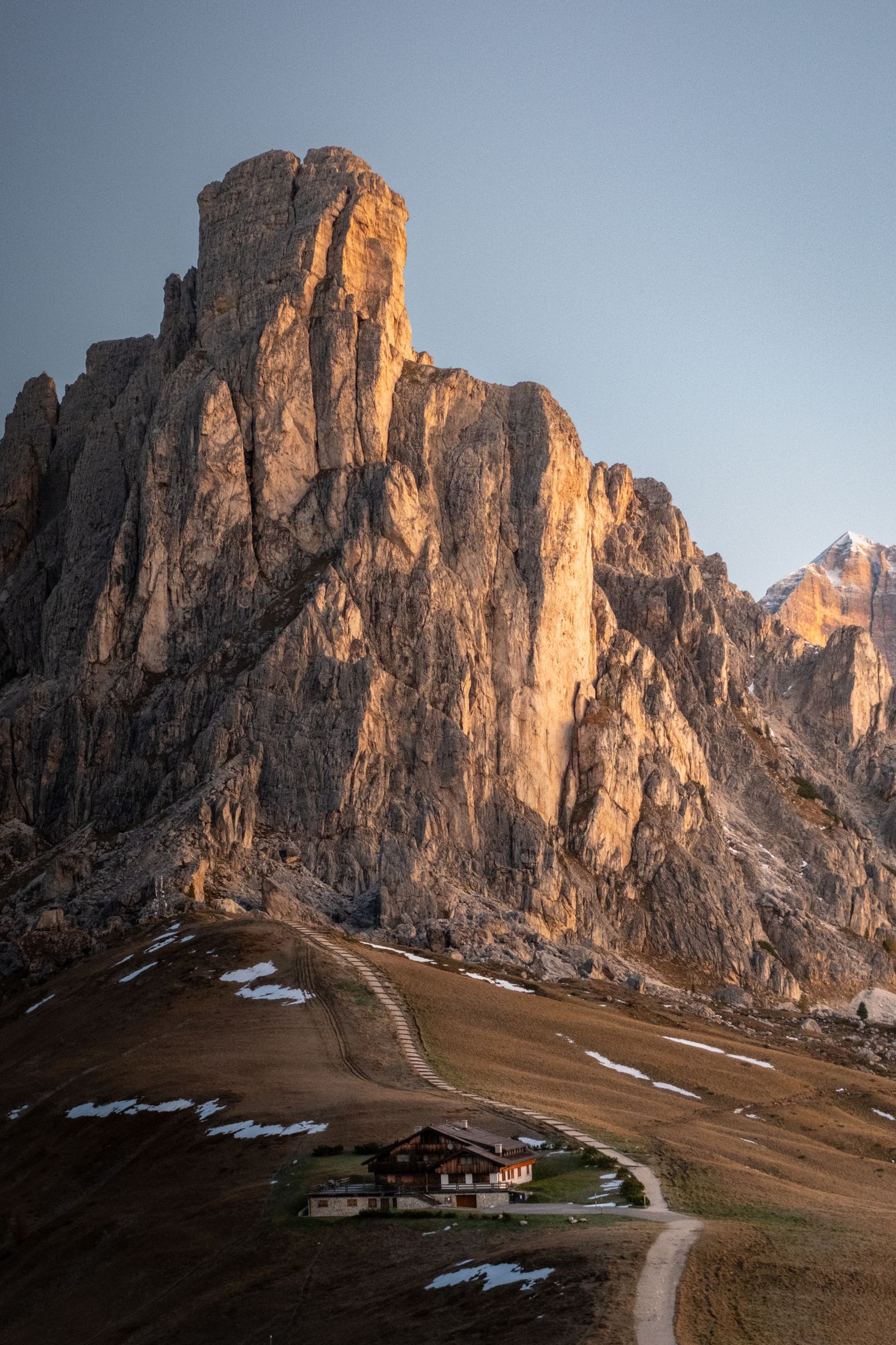
Geographically it threads a sequence of the Dolomites' great massifs. The Fanes plateau first, then the Lagazuoi and the Tofane around Cortina d'Ampezzo, then Pelmo and the vast north-west wall of Civetta, then the Moiazza and the wilder Dolomiti Bellunesi at the southern end. Three protected nature parks are crossed, and the range as a whole received UNESCO World Heritage status in 2009. The pale calcium-magnesium carbonate rock is what produces the enrosadira, the orange-pink glow on the walls at sunset that you will see from most rifugio terraces.
Stage distances and elevation figures follow the Cicerone guidebook's 11-stage breakdown. Day 1 is an arrival and transfer day, and day 8 combines two of the shorter published stages, which is a common and well-supported adjustment given how densely the huts are spaced.
Day-by-day plan
Day 1: Arrive and transfer to Lago di Braies
Fly into Venice Marco Polo or Innsbruck and work north to Dobbiaco or Villabassa, then take the bus in to Lago di Braies. Note that the lake bus can require advance booking in midsummer because of how popular the lake is. Sleep at or near the trailhead. Practically, today is your last easy access to a full-service Italian farmacia. If you are still missing something from your kit, or you take a regular prescription and want a backup supply, this is the day for it. Everything after this is rifugio-only.
Day 2: Lago di Braies to Rifugio Biella (6 km)
Short on distance, honest about the climb: 870 m of ascent in about 6 km, from the turquoise lake up to Rifugio Biella at 2,327 m. It is a good first day precisely because it is brief. You will discover today whether your boots fit and whether your pack is packed correctly, with a manageable distance to reconsider both. Tonight is your first dormitory, communal washroom, and shared tap. Wash your hands with soap before dinner, and keep hand sanitizer with at least 60% alcohol on the outside of your pack for the times soap is not available.
Day 3: Rifugio Biella to Rifugio Fanes (13 km)
Onto the Fanes plateau, high open country with reliable marmot and chamois sightings, then down past Rifugio Fodara Vedla and the Pederu valley before the pull up to Rifugio Fanes at 2,060 m. Pederu is one of only three points on the entire route with a bus connection and a chance to buy provisions. Treat it as a bail-out option and a resupply, not as a medical stop.
Day 4: Rifugio Fanes to Rifugio Lagazuoi (12.2 km)
The biggest climbing day: 1,150 m of ascent finishing at the route's high point, Rifugio Lagazuoi at 2,752 m, perched above the WWI front line where Austro-Hungarian forces tunnelled through the mountain. The tunnel descent is an optional Grade 3 variant and one of the best half-hours on the trek if you are confident on exposed ground. This is also your highest sleeping altitude. A minority of trekkers notice headache, poor appetite, or broken sleep at this elevation. It typically settles by morning, and the gradual profile of the previous three nights works in your favor. Drink more water than you think you need and go easy on the wine at 2,752 m.
Day 5: Rifugio Lagazuoi to Rifugio Nuvolau (12.8 km)
Down to Passo Falzarego, then a traverse beneath the Tofane group to Rifugio Nuvolau at 2,574 m, with Rifugio Averau and the Cinque Torri towers just below. Passo Falzarego is worth marking on your map for two non-scenic reasons: it holds the route's only ATM, and it has a bus down to Cortina d'Ampezzo. If something in your kit has gone wrong by now, this is your one realistic mid-route pharmacy access.
Day 6: Rifugio Nuvolau to Rifugio Citta di Fiume (12.8 km)
The balance flips today: 500 m up, 1,200 m down. There are short cable-aided stretches on this stage, avoidable by a variant if you are uncomfortable with exposure. This is the day most trekkers first notice that descent, not ascent, is what the Alta Via 1 charges you for. Poles out, shorten your stride on the loose sections, and if your knees are complaining, address the inflammation tonight rather than at the end of the week.
Want the health prep for Italy?
Get a 60-second pre-trip check: the vaccines, prescriptions, and altitude/seasonality notes that change the plan — built for your exact dates.
Day 7: Rifugio Citta di Fiume to Rifugio Coldai (9.3 km)
A shorter, more forgiving day across Passo Staulanza and up into the Civetta massif to Rifugio Coldai. Staulanza is your third and final resupply point with a bus link, down to Longarone. Restock snacks and cash here if you did not at Falzarego, because from this point the route runs into progressively wilder country.
Day 8: Rifugio Coldai to Rifugio Carestiato (about 18.5 km)
The long one. Two published stages combined, running beneath the enormous north-west face of Civetta, past Rifugio Vazzoler, and on to Carestiato. Around 18.5 km with roughly 1,070 m of ascent and 1,350 m of descent. Cumulative fatigue tends to peak on a day like this. Prescription-strength ibuprofen, taken as your provider directs, treats the inflammation behind that ache rather than only masking it, which matters when you still have three walking days left. If you would rather not combine the stages, split them and add a twelfth day.
Day 9: Rifugio Carestiato to Rifugio Pramperet (13.2 km)
Across the Moiazza and into the Dolomiti Bellunesi, the quietest and least developed section of the route. You are now as far from a road as you will get all trip. The terrain also starts including more wooded ground, which is where tick precautions become relevant rather than theoretical. Long trousers, permethrin-treated clothing, and a proper body check when you get your boots off at the rifugio.
Day 10: Rifugio Pramperet to Rifugio Pian de Fontana (6.2 km)
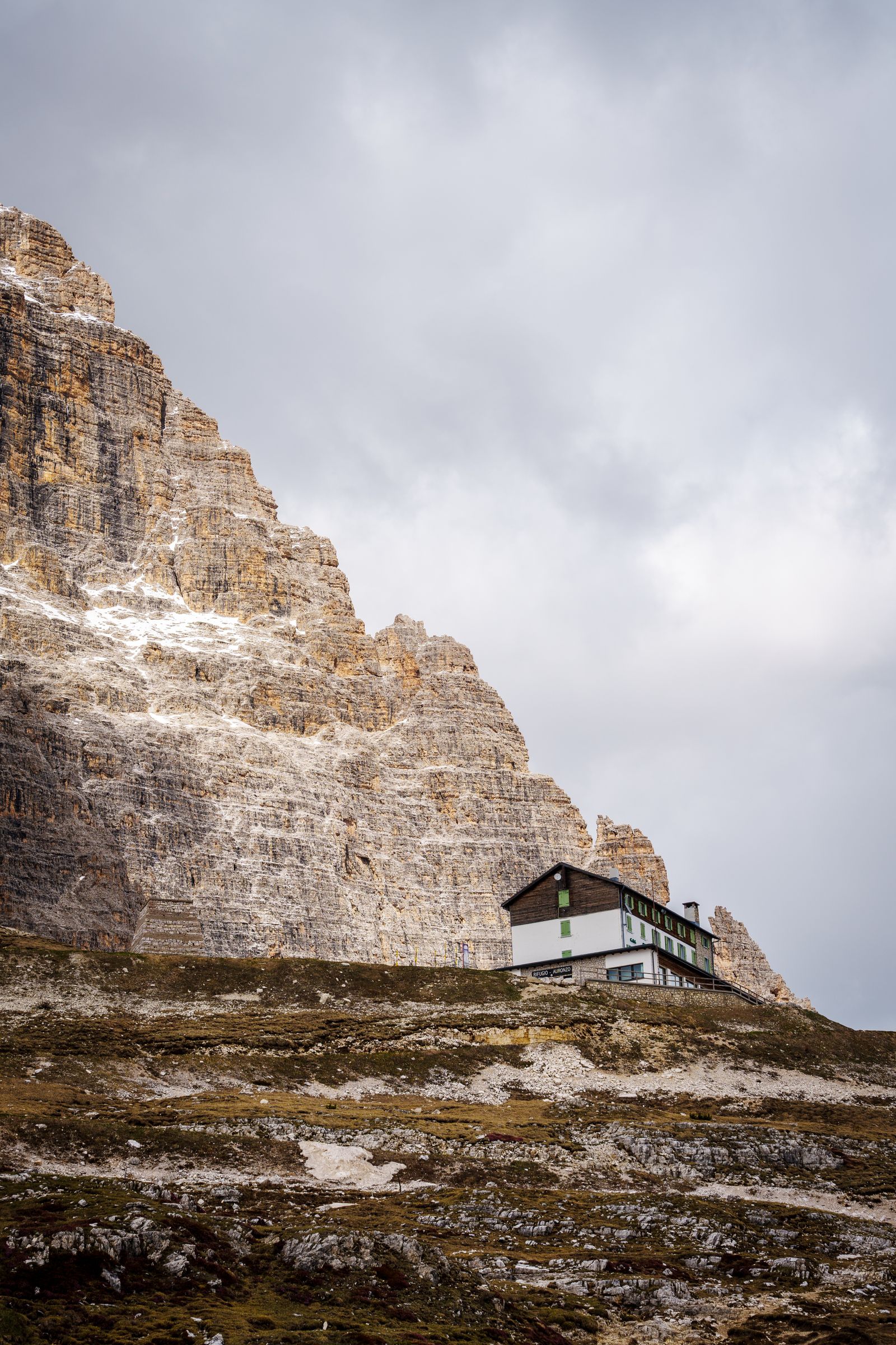
The shortest walking day of the trek, and it exists in this plan on purpose. Six kilometers under the Schiara gives you an afternoon to rest legs that have now absorbed most of 7,700 m of descent. Eat a full dinner, rehydrate properly, and sleep. Tomorrow is not the easy finish it looks like on a map.
Day 11: Rifugio Pian de Fontana to La Pissa, then Belluno (11 km)
Eleven kilometers and 1,400 m of descent to the La Pissa bus stop, then a 20-minute ride into Belluno and trains onward toward Venice. On paper this is a downhill day. In practice it is the hardest single day of the trek for knees, quads, and feet, and it is where poorly fitting boots finally win. Start early, use your poles the whole way down, and take the descent in shorter stages than your ego suggests.
Health prep for this trip
Three things drive the medical planning on this route, and none of them are exotic. First, there is no pharmacy on the trail. Per the Cicerone guidebook there are no shops at all on the AV1, and resupply requires a bus detour at Pederu, Passo Falzarego, or Passo Staulanza. Second, you will eat batch-cooked meals and share washrooms and water taps with 40 to 80 other trekkers, ten nights running. Third, the descent load is genuinely punishing, and joint pain that starts on day 6 has five days left to compound.
For the gastrointestinal risk, CDC puts travelers' diarrhea attack rates at 30% to 70% over a two-week period depending on destination and season, with bacteria responsible for an estimated 75% to 90% of cases, and notes that even in high-income countries restaurant food handling has been linked to diarrhea from organisms such as Shigella sonnei. CDC also does not recommend prophylactic antibiotics for most travelers, which is the right call here. What most providers do recommend for a route like this is a standby self-treat course. A Dolomites Alta Via travel medicine kit covers that: azithromycin for bacterial travelers' diarrhea, dosed 500 mg once daily for three days per CDC's standard regimen, prescription-strength ibuprofen for descent-driven inflammation, and dicyclomine for the cramping that often accompanies both the illness and the antibiotic course. All three should be prescribed by a licensed provider who knows your history and current medications, and none of them substitute for a clinician if symptoms are severe, bloody, or not improving.
On vaccines and bites, CDC guidance for travel to Italy generally covers routine vaccinations plus hepatitis A for some travelers, with no malaria or yellow fever concern on this route. CDC's Italy page does flag that bug bites in Italy can still spread disease and recommends covering exposed skin, using repellent, and considering permethrin-treated clothing if you will be outside a lot, which describes this trip precisely. For the southern woodland stages, CDC states tick-borne encephalitis vaccination may be considered for travelers with extensive planned tick exposure in endemic areas, and notes the main transmission season runs April through November with new foci found up to roughly 2,100 m. Because it is a multi-dose series, that conversation has to happen weeks out.
One more altitude note worth having in advance. Nights four and five are spent at 2,752 m and 2,574 m, above the roughly 2,500 m threshold CDC generally associates with meaningful acute mountain sickness risk. The route's own profile helps: three progressively higher nights precede them. Most trekkers are fine. If you have a personal history of altitude sickness, raise it with a provider before you go rather than discovering it on the Lagazuoi terrace.
What to pack
- Boots with ankle support and non-slip soles, broken in well before you fly, plus trekking poles for the descents
- Your medication kit, azithromycin, prescription-strength ibuprofen, and dicyclomine, in an outside pocket rather than at the bottom of the pack
- Oral rehydration sachets, worth their weight the one time you need them at a rifugio with no shop
- High-SPF sunscreen, sunglasses, and a brimmed hat, since WHO reports UV levels rise roughly 10% to 12% for every 1,000 m of altitude
- Sleeping sheet or bag liner, required at rifugi, plus a small towel (huts do not provide them) and foam earplugs for the dormitory
- Waterproof jacket, over-trousers, and pack cover, plus fleece, hat, and gloves even in July
- Permethrin-treated long trousers for the wooded southern stages, and hand sanitizer with at least 60% alcohol
- Euros in cash, since not all rifugi take cards and the only ATM on route is at Passo Falzarego
Best time to go and what to avoid
The AV1's season is defined by when the rifugi are staffed and the snow has cleared. Outside that window the route is not a trek, it is a mountaineering problem.
The pattern to plan every single day around, in any of those months, is the afternoon thunderstorm. Italian alpine summers build storms from midday onward, which is why the standard advice is to start walking early and be at your rifugio before the sky changes. Being caught high on an exposed traverse in a Dolomites storm is the most likely genuinely dangerous situation on this route, well ahead of anything infectious. Hut guardians are the best weather source you will have, and they will tell you honestly if a stage is a bad idea that morning.
Also plan around booking. Rifugi require reservations in July and August, a confirmation email, and often a deposit. Hut staff will phone ahead to your next hut for you, which is the single most useful piece of AV1 logistics nobody tells you in advance.
Cost expectations
Rifugio half board (dinner, bed, and breakfast) averages around 55 euros per night per the Cicerone guidebook, not including drinks, with CAI and affiliated UIAA members saving at least 10 euros a night. Across ten hut nights that puts your accommodation and food near 550 euros, before transfers, drinks, packed lunches, and the bus and train legs at either end. Cash matters more than usual here: not every rifugio takes cards, and there is exactly one ATM on the route.
Day-by-day plan
| Day | What you're doing | Health note |
|---|---|---|
| 1 | Arrive and transfer north to Lago di Braies Fly into Venice or Innsbruck, transfer via Dobbiaco to Lago di Braies (1,496 m), and sleep at the trailhead. | Your last full-service pharmacy is in the valley towns (Dobbiaco, Villabassa, Cortina). Fill any gaps in your kit today, not tomorrow. |
| 2 | Lago di Braies to Rifugio Biella (6 km, 870 m ascent) A short, steep first climb from the turquoise lake up to Rifugio Biella at 2,327 m. | First rifugio night: shared dormitory, communal washroom, one shared water tap. Wash hands with soap before every meal from tonight onward. |
| 3 | Rifugio Biella to Rifugio Fanes (13 km) Cross the high Fanes plateau, dropping to Rifugio Fanes (2,060 m) via the Pederu valley. | Pederu is one of only three points on the route with a bus link and resupply. Note it as a bail-out option, not a pharmacy. |
| 4 | Rifugio Fanes to Rifugio Lagazuoi (12.2 km, 1,150 m ascent) The biggest climbing day of the trek, finishing at the route's high point of 2,752 m on the Lagazuoi with its WWI tunnel system. | Highest sleeping altitude of the trip. A minority of trekkers notice headache or broken sleep at this elevation, and it usually settles by morning. |
| 5 | Rifugio Lagazuoi to Rifugio Nuvolau (12.8 km) Descend to Passo Falzarego, then traverse under the Tofane to Rifugio Nuvolau (2,574 m) above the Cinque Torri. | Passo Falzarego has the route's only ATM and a bus to Cortina d'Ampezzo. This is your realistic mid-route access point to a real pharmacy. |
| 6 | Rifugio Nuvolau to Rifugio Citta di Fiume (12.8 km, 1,200 m descent) A long descending day with short cable-aided sections, moving toward the throne-shaped Pelmo. | First heavy-descent day. Quads and knees, not lungs, are the limiting factor from here south. |
| 7 | Rifugio Citta di Fiume to Rifugio Coldai (9.3 km) Cross Passo Staulanza and climb into the Civetta massif, ending at Rifugio Coldai. | Passo Staulanza is your last resupply and bus link (to Longarone) until the final descent. Restock what you can. |
| 8 | Rifugio Coldai to Rifugio Carestiato (about 18.5 km, combined stage) The long day: under the great north-west wall of Civetta past Rifugio Vazzoler and on to Carestiato. | Cumulative fatigue peaks around here. Take ibuprofen for inflammation as directed rather than pushing through a hot joint. |
| 9 | Rifugio Carestiato to Rifugio Pramperet (13.2 km) Traverse the Moiazza into the wilder, quieter Dolomiti Bellunesi. | You are now the farthest you will be from a road. Woodland stretches begin, so start a nightly tick check. |
| 10 | Rifugio Pramperet to Rifugio Pian de Fontana (6.2 km) The shortest walking day of the trek, over the Schiara approach to Pian de Fontana. | Built-in recovery. Rehydrate and eat properly tonight, because tomorrow drops 1,400 m. |
| 11 | Rifugio Pian de Fontana to La Pissa, bus to Belluno (11 km, 1,400 m descent) A steep sustained descent to the La Pissa bus stop, then 20 minutes into Belluno and onward trains to Venice. | The single hardest day on knees and feet. Trekking poles matter more today than on any climb. |
Frequently Asked Questions
Usually not. The AV1's high point is 2,752 m at Rifugio Lagazuoi, and the profile builds gradually: your first three nights sit at roughly 1,496 m, 2,327 m, and 2,060 m before you sleep high on nights four and five. That staged progression is close to what acclimatization guidance recommends anyway. CDC generally frames meaningful acute mountain sickness risk as starting around 2,500 m, so the two high rifugio nights are worth knowing about, and a minority of trekkers do report headache or poor sleep there. If you have a personal history of altitude sickness, that is a reasonable conversation to have with a provider about whether [acetazolamide](/medication/acetazolamide) applies to you. For most people on the standard route it is not part of the kit.
The country's risk category is not what changes on this trek, the setup is. Per CDC, travelers' diarrhea attack rates run from about 30% to 70% over a two-week period depending on destination and season, and bacteria account for an estimated 75% to 90% of cases. CDC also notes that even in high-income countries, restaurant food handling has been linked to diarrhea from pathogens such as Shigella sonnei. On the AV1 you eat batch-cooked dinners with 40 to 80 other trekkers, share washrooms and water taps, and rotate a new set of dormitory neighbors nightly for ten days straight. Most trekkers who carry the kit never open it. The ones who need it are typically a full day of walking plus a bus ride from a pharmacy.
There are none on the trail. Per the Cicerone guidebook there are no shops on the route at all, and the only points where you can resupply require a bus detour: Rifugio Pederu on stage 2, Passo Falzarego on stage 4, and Passo Staulanza on stage 6. The route's single ATM is at Passo Falzarego. Realistically, Cortina d'Ampezzo (bus from Passo Falzarego) and Belluno at the finish are your pharmacy options. That gap is the entire argument for sorting prescriptions before you fly rather than assuming you can buy your way out of a problem mid-route.
The AV1 is graded 2 on the Italian scale, described in the Cicerone guidebook as a fairly strenuous alpine walk suited to beginners at multi-day alpine trekking, though not to beginners at walking. Expect roughly 6,660 m of cumulative ascent and about 7,700 m of descent across the route, with daily gains commonly in the 500 to 1,150 m range. Descent is the harder half: your quads and knees absorb more total vertical than your lungs do. Trekking poles and broken-in boots with ankle support do more for your comfort here than aerobic fitness alone.
CDC guidance for Italy typically covers routine vaccinations plus hepatitis A for some travelers, with no yellow fever or malaria concern anywhere on this route. CDC's Italy destination page does note that bug bites in Italy can still spread disease and recommends covering exposed skin, using repellent, and considering permethrin-treated clothing and gear if you spend a lot of time outdoors. For the wooded southern stages specifically, CDC states that tick-borne encephalitis vaccination may be considered for travelers with extensive planned tick exposure in endemic areas. Because that vaccine is a multi-dose series, raise it with a provider at least six weeks out or it will not be an option.
CDC's framework is based on how much the illness interferes with what you are trying to do. Mild symptoms that do not stop you walking generally do not call for an antibiotic. Symptoms that are distressing or genuinely disrupt your day, and especially diarrhea with fever, blood, or severe cramping, are the point at which most providers advise starting a self-treat antibiotic such as [azithromycin](/medication/azithromycin). CDC lists azithromycin 500 mg once daily for three days as a standard regimen, and untreated bacterial diarrhea typically runs 3 to 7 days, which on this route is most of your remaining trek. Hydrate with treated water and oral rehydration solution, and use [dicyclomine](/medication/dicyclomine) for cramping if your provider prescribed it. If symptoms worsen or you see blood, get down to Cortina or Belluno and see a clinician rather than continuing to self-treat.
They are worth taking seriously on the southern woodland stages, roughly days 9 through 11. Long trousers, permethrin-treated clothing, and a careful body check at the end of each walking day are the standard precautions. Per CDC, the main tick-borne encephalitis transmission season in the Northern Hemisphere is April through November, and new TBE foci have been detected at elevations up to about 2,100 m, so altitude alone is not a reason to skip tick checks. Prompt tick removal is the practical priority. Speak with a provider if you develop fever or neurologic symptoms after a bite.
The rifugi season runs roughly mid-June to late September, with some northern Sudtirol huts open into October. July brings peak wildflowers and long days, August is busiest with the most reliable path conditions, and September often delivers the clearest skies and quietest trails. The thing to plan around in every one of those months is the afternoon thunderstorm pattern typical of Italian alpine summers. Start walking early and aim to be at your rifugio before storms build from midday onward. Snow can linger on higher sections in mid-June, and southern huts may close in late September.
Yes, and knowing the exits in advance is part of trekking this route sensibly. Public transport serves Passo Falzarego (stage 4, bus to Cortina), Passo Staulanza (stage 6, bus to Longarone), and Listolade near stage 8. Standard shortened itineraries include a four-day north section from Lago di Braies to Passo Falzarego and a four-day south section from Listolade to La Pissa. If illness or injury forces a decision, dropping to a valley town with a pharmacy and a train station is almost always the better call than pushing one more stage on a route where the next road is a day away.
Alec Freling, MD is a board-certified emergency medicine physician and co-founder of Wandr Health with ER experience treating returning travelers.