
The 9-Day Namibia Itinerary: Sossusvlei and Etosha, The Health-Smart Version

This 9-day Namibia self-drive loop pairs the malaria-free red dunes of Sossusvlei with Etosha National Park, which sits inside the CDC's malaria chemoprophylaxis zone for northern Namibia. The route runs Windhoek, Sesriem, Swakopmund, Damaraland, and Etosha, roughly 1,670 km of tarmac and gravel. CDC recommends malaria chemoprophylaxis, such as atovaquone-proguanil, for all travelers to Etosha and Namibia's northern regions, where every regional strain of Plasmodium falciparum is treated as chloroquine-resistant and transmission peaks February through April after the rains. Sossusvlei and the Namib-Naukluft dunes are too arid for Anopheles mosquitoes to breed. Start your antimalarial before the Damaraland-to-Etosha leg, not on day one.
Most Namibia itineraries treat the country as one trip with one packing list. It is closer to two trips stitched together: a bone-dry desert leg around Sossusvlei where malaria simply is not a factor, and a northern safari leg around Etosha where CDC recommends chemoprophylaxis for every traveler. This 9-day self-drive loop is built around that split, sequencing the malaria-free dunes first and timing your antimalarial to start right as the route turns north. The result is a route that looks like the classic Namibia loop on a map and behaves differently in your travel-medicine kit.
Who this itinerary is for
This is written for travelers renting a 4x4 in Windhoek and self-driving the classic loop: Sossusvlei, the Skeleton Coast at Swakopmund, Damaraland, and Etosha, before returning to the capital. You do not need off-road experience, but you should be comfortable with long stretches of graded gravel road, midday desert heat, and days where the drive itself is the main activity. First-timers to Southern Africa tend to underestimate the distances; this is a big-sky, long-drive country, and the health planning here (heat, hydration, fatigue, and a real regional malaria boundary) matters as much as the wildlife checklist.
It also suits returning Africa travelers who have done a guided lodge-to-lodge safari before and want the independence of driving themselves. Namibia is one of the more forgiving self-drive countries on the continent: roads are well maintained by regional standards, signage is reliable, and English is widely spoken. The tradeoff is that you are your own logistics team. There is no guide managing your water supply, fuel range, or pace, which is exactly why the health planning on this route lives in the driving days as much as the wildlife days. For a broader look at the country's overall health picture beyond this specific route, see Wandr's Namibia travel health guide.
The route
The loop runs Windhoek, south and west to Sesriem for the dunes, north to the coast at Swakopmund, inland through Damaraland, and finally to Etosha before returning to Windhoek, a circuit of roughly 1,670 km. The logic is geographic and clinical at once: the southern and central legs sit in the hyper-arid Namib, where there is no standing water for Anopheles mosquitoes to breed, while the final third of the trip crosses into Namibia's northern belt, the region CDC names for malaria chemoprophylaxis. Running the trip in this order, dunes first, safari last, means your one clinical decision point (when to start Malarone) lines up naturally with the day you actually cross from the malaria-free south into the risk zone, rather than asking you to start a daily pill on day one for a risk you have not reached yet.
Nine days is enough to do this loop without feeling rushed, but it is a tight nine days. Most of the driving legs run 250 to 360 km, which sounds modest until you factor in gravel-road speeds that rarely exceed 80 km/h, photo stops, and the simple fact that fuel stations thin out the moment you leave the B1 tar road south of Windhoek. Travelers with more time often add a second night at Sesriem or a rest day in Swakopmund; travelers with less sometimes cut Damaraland and drive Swakopmund to Etosha directly, which shortens the trip but loses the desert-elephant and rock-art stop, and slightly changes when the Malarone clock should start, since you would then be entering the true chemoprophylaxis zone a day earlier.
Day-by-day plan
Day 1: Arrive Windhoek
Land at Hosea Kutako International Airport, clear customs, and collect your rental 4x4. Windhoek sits at roughly 1,655 m (5,430 ft), well under CDC's approximately 2,500 m threshold for altitude illness, so there is no acclimatization day built in here, just a jet-lag one. Spend the afternoon walking Windhoek's compact center, confirm your rental has two spare tires, a full-size jack, and a working phone-charging setup, and get to bed early. The drives ahead are long enough that starting rested matters more than an ambitious first-day sightseeing list.
Day 2: Windhoek to Sesriem
The drive toward the Namib-Naukluft runs roughly 340 km, a mix of tar and well-graded gravel through Rehoboth and the Tropic of Capricorn. This is the first of several days where fuel stops are genuinely sparse, so top off whenever you see a station rather than waiting for the tank to run low. Everything from here through the Deadvlei walk on day 3 sits in malaria-free desert, one less thing to plan around for these two days.
Day 3: Sossusvlei and Deadvlei at sunrise
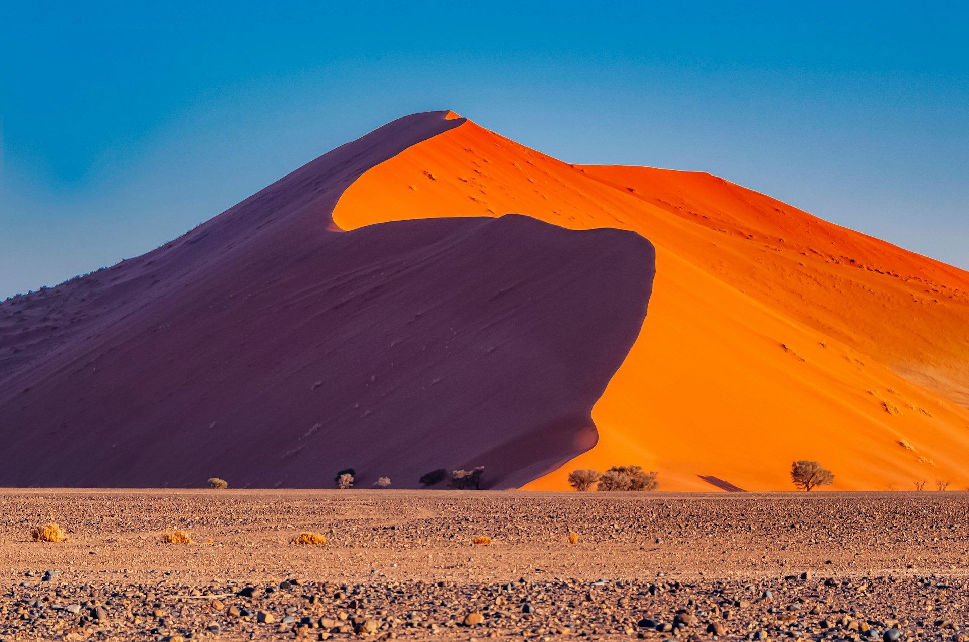
Enter the park at gate-opening time to catch the dunes in the low morning light, when the color is best and the heat is manageable. Climb Dune 45 or the taller Big Daddy, then walk out across the cracked white clay pan to Deadvlei, where 900-year-old camel thorn trees stand black against red sand and blue sky. Surface sand temperature climbs fast once the sun is high, well past the shaded air temperature, so plan the physical part of the day for before 10 a.m. Carry at least 2 liters of water per person and treat a headache or nausea later in the day as a heat-and-hydration problem first.

Day 4: Sesriem to Swakopmund
The scenic route to the coast runs the C14, roughly 360 km of gravel through the Gaub and Kuiseb canyons, dropping from desert plateau to the cool Atlantic fog belt by afternoon. This is the longest single gravel-driving day of the trip. If you are traveling with a second driver, swap every 90 minutes to two hours; washboard gravel and long, low-traffic stretches are more fatiguing than they look on the map, and fatigue behind the wheel is a bigger practical risk on this route than any infectious disease.
Want the health prep for Namibia?
Get a 60-second pre-trip check: the vaccines, prescriptions, and altitude/seasonality notes that change the plan — built for your exact dates.
Day 5: Swakopmund and Cape Cross
Swakopmund is a genuine change of pace, a cool, foggy German-colonial town on the Atlantic where the Namib meets the sea. Spend the morning on the Walvis Bay lagoon (flamingos and pelicans are reliable here) and the afternoon at the Cape Cross seal colony, home to one of the largest Cape fur seal breeding colonies in the world. Stay on the designated boardwalks and skip any hands-on contact with the animals; CDC has flagged documented rabies activity in Cape fur seal populations along this stretch of coast, and that guidance applies to curious travelers as much as to researchers.
Day 6: Swakopmund to Damaraland
North along the Skeleton Coast, then inland to Twyfelfontein, roughly 290 km, for a UNESCO World Heritage rock-engraving site and a real chance at spotting desert-adapted elephants along dry riverbeds. Damaraland sits inside Kunene region administratively, one of the regions CDC names for malaria risk in Namibia, though the risk itself concentrates along the Kunene River corridor on the Angola border, well north of the arid Twyfelfontein-Palmwag circuit most itineraries actually cover. Because tomorrow's drive continues straight into Etosha, an unambiguous chemoprophylaxis zone, most travelers simply start their antimalarial before this leg rather than try to draw a precise regional line.
Day 7: Damaraland to Etosha
The drive to Etosha's western Anderson Gate runs about 250 km. Check in at Okaukuejo, whose floodlit waterhole is one of the best wildlife-viewing spots in Southern Africa after dark, and take a first afternoon game drive. If you have not already, this is the day to take your first Malarone dose, 1-2 days before entering the malaria area is the standard CDC-aligned window, continuing daily with food for the rest of the trip.
Day 8: Full day in Etosha
Spend the full day working the park's waterholes between Okaukuejo and Halali or Namutoni. Etosha covers roughly 22,270 sq km centered on a vast salt pan, and in the dry season game concentrates hard around the handful of remaining water sources, which is also when Anopheles mosquito activity is lowest. Keep repellent on for the dawn and dusk drives regardless of season; those are the hours mosquitoes are most active, and they are also prime game-viewing hours, so you will be outside for both.

Day 9: Etosha to Windhoek and departure
An early final game drive, then the long transit south, roughly 430 km, back to Windhoek for an evening flight. Keep taking your Malarone through this drive and for the full week after you land at home; the 7-day post-exposure course is the part travelers most often shortchange once the safari itself is over.
Health prep for this trip
Six weeks out, see a travel health provider about routine vaccines plus Hepatitis A and B and Typhoid, which CDC recommends for most travelers to Namibia. Three to four weeks out, get your prescriptions sorted through a service like Wandr's Namibia travel medicine visit so atovaquone-proguanil and azithromycin are ready well before departure. Fill both prescriptions one to two weeks out. The single clinical decision point on this trip is timing: start Malarone 1-2 days before the Damaraland-to-Etosha leg on day 6 or 7, not on day one, since the first five days of this route sit in malaria-free desert. Rabies vaccination is worth a conversation with your provider too, given the extended outdoor exposure and the Cape Cross seal colony stop.
What to pack
Pack more water capacity than feels necessary (a few extra collapsible bottles or a jerry can beyond what the rental includes), broad-spectrum sunscreen and a wide-brim hat for the dune climb, layers for Swakopmund's cool coastal fog against Etosha's dry heat, and a basic traveler's diarrhea kit built around azithromycin and oral rehydration salts. Binoculars matter more than you expect for Etosha's waterhole game viewing, and a paper map or downloaded offline maps are worth carrying since gravel-road cell coverage is unreliable for long stretches between Sesriem, Swakopmund, and Damaraland.
Also worth the packing list: a headlamp for early departures out of camp before the Sossusvlei gate opens, a dust-proof bag or case for cameras and phones on the gravel legs, and closed shoes rather than sandals for the dune walk, since the sand surface can burn bare feet by mid-morning. If you are self-catering at any point, treat or boil water from anything other than a sealed bottle or a lodge tap you have specifically been told is safe.
Best time to go and what to avoid
The dry season is the more forgiving choice on both counts, wildlife concentration and malaria risk trend the same direction. If you travel in the wet season for the greener landscapes and lower crowds, the malaria guidance does not change, chemoprophylaxis is still recommended for Etosha and the north year-round, but your personal exposure risk is genuinely higher, so dose discipline matters even more.
Cost expectations
A self-drive Namibia trip runs mid-range by African safari standards: a 4x4 rental with camping or guesthouse-level lodging typically lands in the low thousands of dollars per person for a trip this length, before flights, with fuel and gravel-road wear-and-tear insurance as real line items most first-timers underbudget. Lodge-based stays at Sossusvlei and Etosha, especially anything with a private waterhole view, push the number up considerably, sometimes doubling the per-night cost of the coastal and Damaraland legs. Namibia's currency, the Namibian dollar, is pegged to the South African rand, and both are accepted in most tourist areas, though carrying some cash is worth it for fuel stops in smaller towns where card machines are not always reliable. Either way, budget for a proper travel-medicine visit and prescriptions as a fixed cost early, not an afterthought once you are already packing.
Day-by-day plan
| Day | What you're doing | Health note |
|---|---|---|
| 1 | Arrive Windhoek Land at Hosea Kutako International Airport, collect your 4x4 rental, and settle in Windhoek for the night. | Windhoek sits at roughly 1,655 m (5,430 ft), well under the CDC's ~2,500 m threshold for altitude illness, so this is a jet-lag day, not an acclimatization day. Hydrate on the flight and confirm your rental has two spare tires and a full-size jack before you leave the lot. |
| 2 | Windhoek to Sesriem Drive south and west toward the Namib-Naukluft, roughly 340 km on a mix of tar and graded gravel, arriving at Sesriem by afternoon. | This stretch and everything past it is malaria-free desert. Save water in the car regardless; fuel and shade stops thin out fast once you leave the B1. |
| 3 | Sossusvlei and Deadvlei at sunrise Enter the park before the gate opens for the golden light, climb Dune 45 or Big Daddy, and walk out to Deadvlei's petrified camel thorn trees. | Midday surface temperatures in the dunes routinely exceed air temperature by a wide margin. Do the dune climb at first light, carry at least 2 liters of water per person, and treat any headache or nausea after 10 a.m. as a reason to head back to shade. |
| 4 | Sesriem to Swakopmund Cross the Namib on the scenic C14 gravel route through the Gaub and Kuiseb canyons to the Atlantic coast, about 360 km. | A long gravel driving day. Swap drivers every 90 minutes to 2 hours if you can, since fatigue on washboard gravel is a bigger real-world risk on this route than any infectious disease. |
| 5 | Swakopmund and Cape Cross A cool, foggy coastal day: the Walvis Bay lagoon, dune activities outside town, and an afternoon at the Cape Cross seal colony. | Cape Cross holds one of the world's largest Cape fur seal colonies, and CDC has flagged rabies activity in Cape fur seal populations along the Namibia and South Africa coast. Keep your distance from the animals and skip any hands-on contact. |
| 6 | Swakopmund to Damaraland North along the Skeleton Coast, then inland to Twyfelfontein, about 290 km, for rock engravings and a chance at desert-adapted elephants. | Damaraland falls administratively inside Kunene region, one of the CDC's listed malaria regions, but the arid Twyfelfontein-Palmwag circuit sits well outside the Kunene River corridor where that regional risk actually concentrates. Most providers still have travelers start prophylaxis before this leg since the drive continues straight into Etosha the next day. |
| 7 | Damaraland to Etosha Drive roughly 250 km to Etosha's western Anderson Gate, check in at Okaukuejo, and take a first waterhole-side game drive. | You are now inside the CDC's malaria chemoprophylaxis zone. If you have not already, take your first Malarone dose today, 1-2 days before entering is the standard window, and keep taking it daily with food through the rest of the trip and 7 days after you leave. |
| 8 | Full day in Etosha A full day of game drives between Okaukuejo and Halali or Namutoni, working the floodlit waterholes at dawn, midday, and dusk. | Etosha's 22,270 sq km pan draws game to a shrinking set of waterholes in the dry season, which is also when Anopheles mosquito activity is at its lowest. Keep repellent on for the dawn and dusk game drives regardless. |
| 9 | Etosha to Windhoek and departure An early final game drive, then the long transit south, roughly 430 km, back to Windhoek for an evening flight. | Continue your Malarone through this drive. The 7-day post-exposure course runs past your flight home, so pack enough tablets for the trip plus a full week after landing. |
Frequently Asked Questions
Most likely yes for part of the trip, not the whole thing. Sossusvlei, Deadvlei, and the wider Namib-Naukluft are too dry for Anopheles mosquitoes to breed, so that leg is malaria-free. Etosha National Park and Namibia's northern belt (Kavango, Kunene, Ohangwena, Omaheke, Omusati, Oshana, Oshikoto, Otjozondjupa, and Zambezi regions) are different: CDC recommends malaria chemoprophylaxis for all travelers to these areas. Because the classic Namibia loop pairs the dry-desert leg with the Etosha leg on one trip, most travelers carry a chemoprophylaxis like atovaquone-proguanil and take it for the northern half of the route.
One tablet by mouth, once daily, with food. Start 1-2 days before you enter the malaria zone, which on this itinerary means starting on or just before the Damaraland-to-Etosha drive on day 7, continue every day while you are in Etosha and the north, and keep taking it for 7 days after you leave the zone, which on a Namibia trip usually means 7 days after you fly home. Take it with your evening meal to improve absorption and reduce stomach upset, and set a phone reminder, since long driving days are an easy way to miss a dose.
Yes. The Namib is one of the driest deserts on Earth, and Anopheles mosquitoes need standing water to breed, which the Namib-Naukluft and the Sossusvlei-Deadvlei area do not reliably have. CDC's country guidance for Namibia does not list the southern and central Namib among the risk regions. That said, malaria prevention is a regional question, not a whole-country one, and this itinerary crosses into a genuine risk zone once you reach Etosha.
It is a gray area worth understanding rather than a clean yes or no. Damaraland sits within Kunene region, which CDC lists among Namibia's malaria regions, but the risk in Kunene concentrates along the Kunene River on the Angola border, well north of the arid Twyfelfontein-Palmwag circuit most Damaraland itineraries actually visit. Because this route continues straight from Damaraland into Etosha, which is an unambiguous chemoprophylaxis zone, the practical answer most providers give is to start your antimalarial before the Damaraland leg rather than try to draw a precise line mid-region. Speak with a provider about your specific route if you are extending further north toward Epupa Falls or the Kunene River itself.
Not for this itinerary. Namibia is not classified by CDC as having endemic or transitional yellow fever risk, so routine vaccination is not recommended for travel confined to the country. Proof of yellow fever vaccination may be required at the border only if you are arriving from a country with yellow fever risk, so check entry requirements if your trip connects through one.
Tap water in Windhoek, Swakopmund, and most established lodges is generally treated and safe, but rural boreholes and campsite taps on a long self-drive are inconsistent. The simplest approach is to drink bottled or filtered water once you are outside the main towns and to carry more water than you think you need between fuel stops, since distances between reliable resupply points can run past 100 km. Traveler's diarrhea is still the most common health complaint on a Namibia trip, so pack azithromycin as backup.
Beyond routine immunizations, CDC recommends Hepatitis A and B and Typhoid for most travelers to Namibia, and rabies vaccination is worth discussing with a provider given the extended outdoor and wildlife exposure on a self-drive safari, plus the documented rabies activity in Cape fur seal colonies like Cape Cross along this route.
The main consideration is rabies, not infectious disease from the water or air. CDC has noted rabies activity among Cape fur seal populations along the Namibia and South Africa coastline. The practical guidance is straightforward: view the colony from the designated boardwalks, do not touch or feed the seals, and if you plan extensive watersports or close animal contact anywhere on the trip, ask a provider about pre-exposure rabies vaccination before you go.
Yes, and that overlap is worth planning around. Namibia's dry season, roughly May through October, is both the best wildlife-viewing window, because animals concentrate at Etosha's remaining waterholes, and the lower-risk window for malaria, since mosquito activity drops with the rains. The wet season, November through April, scatters the wildlife and includes the February-to-April peak in regional malaria transmission. Chemoprophylaxis is still recommended for Etosha and the north year-round regardless of season; the seasonal difference affects your odds, not the CDC recommendation.
The Wandr Team is the editorial group at Wandr Health; every article is reviewed by a licensed clinician before publication.